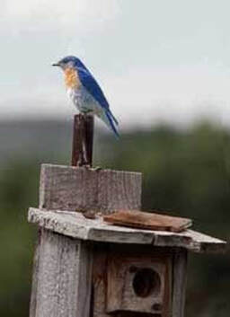
RECREATION
Parks Hunting & Fishing Camping/Trails Mine Kill Lansing Manor
www.visitSchoharieCounty.com
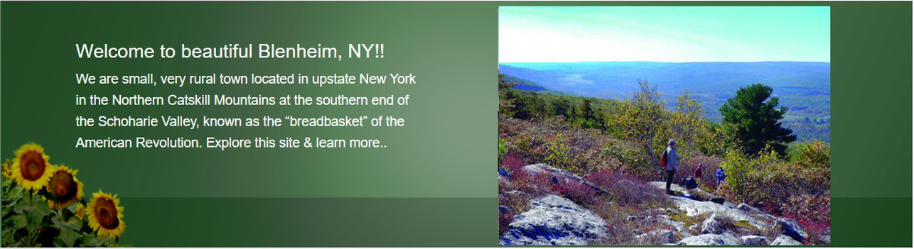
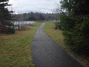
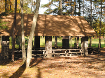
Blenheim’s scenic beauty, access to outdoor recreation, and location within a wealth of state forest lands are highly valued by the community. There are two primary town parks in Blenheim. One park is located behind the Town Hall, offering picnic tables, a pavilion, and community-wide access to the creek. The second, Bridge Park is the most active community open-space area within the hamlet. This park is commonly used as an outdoor gathering space for Blenheim community events and picnics.
Proximity to Capital District and NYC – All distances are approximate: 40 miles from the Capital District; 150 miles from NYC; 225 miles from Boston; 240 miles from Philadelphia; 270 miles from Montreal; 275 miles from Ottawa; 375 miles from Washington, DC and Toronto. Other metropolitan areas within 400 miles include: Providence, RI; Hartford, CT; Syracuse, NY; Rochester, NY; and Buffalo, NY.
Streams running through the Town are the Schoharie Creek, Mill Creek, West Kill, Mine Kill, Betty Brook, Cole Brook, and Doney Hollow Creek.
Parks Hunting & Fishing Camping/Trails Mine Kill Lansing Manor
www.visitSchoharieCounty.com
Blenheim’s scenic beauty, access to outdoor recreation, and location within a wealth of state forest lands are highly valued by the community. There are two primary town parks in Blenheim. One park is located behind the Town Hall, offering picnic tables, a pavilion, and community-wide access to the creek. The second, Bridge Park is the most active community open-space area within the hamlet. This park is commonly used as an outdoor gathering space for Blenheim community events and picnics.
Proximity to Capital District and NYC – All distances are approximate: 40 miles from the Capital District; 150 miles from NYC; 225 miles from Boston; 240 miles from Philadelphia; 270 miles from Montreal; 275 miles from Ottawa; 375 miles from Washington, DC and Toronto. Other metropolitan areas within 400 miles include: Providence, RI; Hartford, CT; Syracuse, NY; Rochester, NY; and Buffalo, NY.
Streams running through the Town are the Schoharie Creek, Mill Creek, West Kill, Mine Kill, Betty Brook, Cole Brook, and Doney Hollow Creek.
|
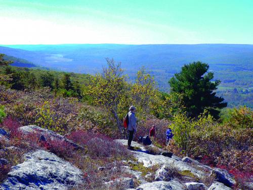
Forest Land
Burnt-Rossman Hills State Forest Located in Schoharie County on Burnt-Rossman Hills State Forest, Looking Glass Pond provides opportunities for fishing and boating. Accessible features include a pathway to the pond with a canoe launch, and fishing pier. An accessible path at Looking Glass Pond Directions: From points North: Take St. Hwy. 30 South of Fultonham. Make a right onto West Fulton Road (sign at that junction shows Looking Glass Pond). Follow West Fulton Road to Rossman Hill Road. Make a left onto Rossman Hill Road and follow to Looking Glass Pond. From points South: Take St. Hwy. 30 North of Blenheim. Make a left onto West Fulton Road and proceed as above. Other access points and camping sites located off West Kill Road. Mine Kill State Park Rt. 30, Blenheim, NY https://parks.ny.gov/parks/minekill
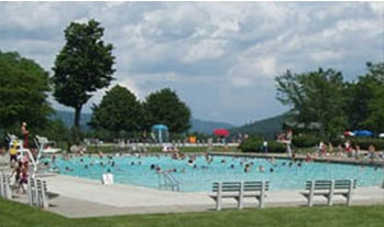
Located in the scenic Schoharie Valley, Mine Kill State Park overlooks the NY Power Authority's Blenheim-Gilboa Pumped Storage Power Project. The entire park is free, year round, courtesy of the New York Power Authority. The park has numerous picnic areas, a pavilion and several other shelters, playgrounds for all ages and ballfields. A recent addition to the park is an 18-hole disc golf course. Providing good fishing opportunities, the lower reservoir is stocked with trout and walleye, and has several other species, including bass and is ideal for motor boating, kayaking and water skiing. Minekill State Park has an Olympic size pool, wading pool and a diving pool also available at no cost. Swim lessons are taught in the summer months--please contact the park office for details. Other warm weather activities include hiking and mountain biking on the parks 8 miles of trails. Cascading 80 feet through a narrow gorge is the picturesque Mine Kill Falls for which the park is named. A separate parking area, 1/4 miles south of the parks' main entrance, provides access to the overlook viewing platforms, as well as the Long Path hiking trail to the lower falls and beyond. In winter, visitors enjoy snowshoeing, cross-country skiing and snowmobiling. Pets Household pets only; caged or on a leash not more than 6 feet, rabies vaccination and proof of same required. Not permitted in buildings or bathing areas. |
An accessible path at Looking Glass Pond
|
|
Max V. Shaul State Park Rt. 30, Fulton, NY https://parks.ny.gov/parks/94/
Max V. Shaul State Park is a small, quiet camping area with 30 wooded tent and trailer sites. The park has shady picnic grounds, a pavilion available for rent as well as playing fields and a playground. Fishing access is available at the Schoharie Creek, a short walk from the parking lot through the ball fields. Pets Household pets only; caged or on a leash not more than 6 feet. Rabies vaccination and proof of same required. Not permitted in buildings. For campers, if your site allows pets, there is a two-pet maximum. BLENHEIM-GILBOA Visitors Center - Rt. 30, Blenheim, NY
New York Power Authority Visitors Center and Historic Lansing Manor The visitor experience at Blenheim-Gilboa is a triple play. The science of electricity and hydropower is on exhibit at the Visitors Center. Right beside it, history is preserved at Lansing Manor, a 19th century home. And it's all surrounded by trails, boating, fishing and other outdoor recreation. The Blenheim-Gilboa Visitors Center features a wide range of interactive exhibits on such subjects as Basics of Electricity, Uses of Electricity and operation of the Blenheim-Gilboa Pumped Storage Power Project. The Blenheim-Gilboa VIsitor Center is open daily, year-round, for guided tours from 10 am to 5 pm. Lansing Manor is filled with authentic furnishings and priceless antiques from the first half of the 19th century. The Manor, listed in the National Register of Historic Places, contains 10 large rooms on two floors, plus a below-ground kitchen and other utility rooms and is a classic example of Federal period architecture. Built in 1819 by John Lansing, who represented New York as a delegate to the Constitutional Convention in 1787, the manor house was restored by the Power Authority in 1977 and has been renovated since. A history buff's dream come true, The Manor is operated by NYPA and is open daily from May through October for guided tours from 10 am to 5 pm. The complex is located at 1378 St. Rt.30, North Blenheim, 17 miles south of Middleburgh and 5 miles north of Grand Gorge, about on hour from Albany. Additional historic events are held throughout the year. Admission to the Manor, Visitors Center and events is always free. School groups, community organizations and coach operators are welcome. For further information and a complete calendar of events, please call 1-800-724-0309 or visit us on the web at www.nypa.gov. We encourage you to come learn about the history of power and the power of history! Long Path - Hike the Long Path
Extending 356 miles from Ft. Lee historical park in New Jersey to NY Route 146 in Altamont, near Albany, the Long Path is a thread connecting many of New York’s parks, preserves, and State Forest Lands. The Long Path (aqua blaze) begins in Ft. Lee, New Jersey. Crosses into Rockland County, New York. Enters Harriman State Park. Joins the Shawangunk Ridge Trail in Greenville. Crosses the Rondout Valley to traverse Catskill Park. North of Gilboa, the trail follows the western ridge of the Beautiful Schoharie Valley. The trail passes through Mine Kill Falls State Park and the Blenheim-Gilboa Visitors Center of the New York State Power Authority. Then heads west, then north through another series of reforestation areas of Blenheim, NY. East of Patria, the Long Path descends into the Schoharie Valley crossing Vroomansland then ascends Vroomans Nose. Past the cliffs, the trail leaves Schoharie Valley and heads east. It crosses State Forests to reach Partridge Run Wildlife Management Area in Albany County. The current official northern terminus of the Long Path is Rt. 146 in Altamont. |
|